
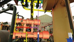
Photogrammetry
Photogrammetry survey is the basis of high-resolution digital image capture. This highly precise and adaptable data can be employed in many ways, from an accurate record of the as-built status of a facility to 3D visualisation. Our experienced engineers will ensure that the key parts of the Client’s process/site are captured to obtain accurate as-built information, this is the fundamental tool for the success of any plant modification project.
Scan to CAD Model
3D CAD models are constructed using the laser scan data and photogrammetric survey. Overlaying the photogrammetry with the new 3D CAD Model presents real time views of the proposed design avoiding unexpected difficulties arising during the construction phases.
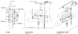
Orthographic
Our laser scanning services take real-life point cloud data from which we derive an “As-Built” 3D model for BIM integration and subsequently transpose it to 2D Orthographic Drawings.
CONTACT US